
I almost gave up my hope to be a mountaineer.
Taking up an unfamiliar mountain even classified as level 1, with hardly any experience at all, proved to be a loooooot difficult and potentially dangerous for us novices than I had expected.
Mt. Kalisungan in the towns of Calauan and Nagcarlan in Laguna came as a prospect for a day climb. 745 meters above sea level, it was identified as an easy climb with only two hours to burn.
Coming from alabang, I assumed it will not eat up the entire day climbing through Erais farm in Calauan and making a traverse via the atimlia trail to Nagcarlan so I squeezed in bunga falls, a possible trek to nagcarlan underground cemetery, and a dinner overlooking the lakes of San Pablo city. It was an ambitious and naive itinerary I realized after.
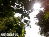
The calamba bus liner was our first ride going to Calauan. The bus snaked thru morning traffic in Calamba and Los Banos before we alighted in Brgy. Masapang. It was marked by a huge maroon duck statue with an equally large egg underneath. We then hired a tricycle to drop us at Erais farm. Even seated inside the sidecar, I saw how the mountain towered over the town. And my excitement leveled up.

Walking near the foot of it, I felt dwarfed. Maybe it was the direct frontal view of the mountain that I started to feel like, “can I really do it?” It was like the mountain was confronting me, a giant ready to pounce. And I was still pondering when early on the climb, we already missed the first trail. Instead of going towards the trek, we found ourselves in a local’s door. “Was that bad omen?”
Leaving behind discouraging thoughts, we cut through the grass back towards the mountain trail. It was a muddy trail, an effect of the rain of previous day. We were unprepared. We brought only a liter of water each. We knew we underestimated this climb, nonetheless, we continued.
On first obvious fork, we took the left one on to another farmer. He was very helpful though and brought us back to the right trail and cleared the path for us. He advised us not to go west and just follow the trail straight up; along the way were 14 Stations of the Cross, he told us. Ten minutes more and we met another dubious fork. The right trail was clean and established. I checked on the left since “manong” told us not to make a right but it was covered. Decidedly, we went for the trail on the right (should have been otherwise), passing thru mosquitoes, ants, and felt my shoes thickening with soil.

Another ten minutes and we came to a halt; neither was there any continuing trail nor any signs of the cross. Only evident of a previous presence was a stack of young coconut shells. The good thing though in climbing this mountain was that you always get a good view of the Talim Island. But had we known better, we should have retraced our tracks back. Instead, we tried making our own trail, walked along more coconut, banana, and gabi farms, bushes and lots of interlaced branches of trees. And snake holes. I in the lead and frightened as I was, it was not seldom that I did not see anyone behind me. I was walking and walking, wanting to end the hike, trying to find an easier less panicky way.
One of us asked me to stop and I came back into my senses. I was not alone, not the only one who was tired and lost. And uncomfortable. And though we were, we started to enjoy the climb again despite drizzles of rain and a couple of slips. Each unique view of the lowlands and the other mountains on the west refueled us. The camaraderie and the sharing of the group were sustaining my strength.

It was passed 12 noon, 3hrs into hike when we took our lunch and rest in a hut. We knew we were nearing the top but we were still clueless. There were a couple of trails and we decided to follow the steepest.. 5 minutes later we reached a bay of sweet potatoes. Further up was a cogon country blocking us. We tried to walk around it to the left where there was a ‘dalandan” farm, however, even that was impassable. I was tempted to climb an old tree if only to survey the area but I could hardly see where I was stepping on. So we went back where it was safer and had a master-view.
It could have been better at the peak. It was way passed 2pm and I wanted to see the station of cross but up until here we never saw a piece. No matter how I strained my neck and eyes, I did not have a glimpse of the big cross I was about to see at the top. I was aching for it.
The cogon was thick and I blindly hoped that 15 or so meters into it, we’ll be back into a clean track and considerably closer to where we were heading. We took a branch of a young kakawate tree to help us navigate. For a couple of minutes, we shoved, broke, stepped. It was exhausting, the more we went up, the more we found ourselves immersed in grass with height reaching way much than ours and the only way we can survey the area was for someone to stand on another’s shoulder.

I stood up, my legs were shaking. My eyes failed me. We pushed and broke and stepped faster until I doubted what I saw. For the second time, I went up, and almost lost my balance. I almost saw myself flying into the air, hands flailing, head into the stones. Then I saw and accepted it. It would take us another hour to cross and at 4pm, there was no way for us to see the peak that I so desired that day. That meant we need to camp, and we were not ready. Though we brought tent, and packed food, we barely had enough water to last us. It was disconcerting. I felt humbled. It took us 6hrs of hike and we missed what we went for. I felt a 50 pound barrel weighing on my foot my first step down.
The adversities did not end there. The drizzles only worsened the condition and the slippers were straining legs already. We tried to follow our previous path but we could hardly distinguish any. Just as we thought we were pursuing home, we realized we missed again. The only way we could track back was to keep going right which meant passing division of lands that was fenced by uncleaned patches, where they allowed the grass, vines, trees, and bushes deliberately unkept. In the dense bushes, I felt the snakes watching, smelling. And with every step, I felt their breathing and mine.
I used the kakawate for checking out sudden gap in the steps to keep from injury. Then I heard a scream. My mate sprained a shoulder when there was a slip, stopped, held onto a branch and strained. I too had slipped and sprained my palm but this was minute compared to the other. Then it was dusk. I felt desperate for water, for bath, for hot food, for home. I missed the comfort and was unsure if we can make it at the foot before nightfall. We kept going right and braved numerous dangerous gaps.
Then finally when I looked down I saw a trail. Afterwards was an easier descent. We saw only one station though. The typhoons had broken the small wood and luckily, still posted was a depiction of the Saviour’s love for humanity.

Back on the streets we ate fishballs, squidballs, and softdrinks. sooo extra good and familiar. At the intersection, we cleaned up in kainan sa kamalig, and had adobo and nilagang pata ng kalabaw for dinner. Across was an option to feast on kambing or a not so exotic meal in laguna garden resto, and itik lovers would love the foodstand nearby, their specialty is kinulob na itik.
Safer and more secured, it was easier to talk about the stress, the disappointments, the highs and the lows of this mountain and the experience. I almost got a whacking for suggesting beaches and giving up on mountains. Truly it was a test of character, patience, and judgment calls. It was wrong to brag and challenge it. Clearly, I was a new person going down that mountain. I did not reach the top but one day I will be up again and respect the mountain for what it really is.
Linked Post:
> Finally: The SUMMIT - Mt. Kalisungan Part 2


2 comments:
very interesting trek and a good journal.
hi. you had inspired me to write the 2nd part (finally: the summit) which i had long been procastinating.
hope you also get to read that 2nd part.
Post a Comment